Nearest Park Mapping: Why Measuring Walking Access to Public Green Space
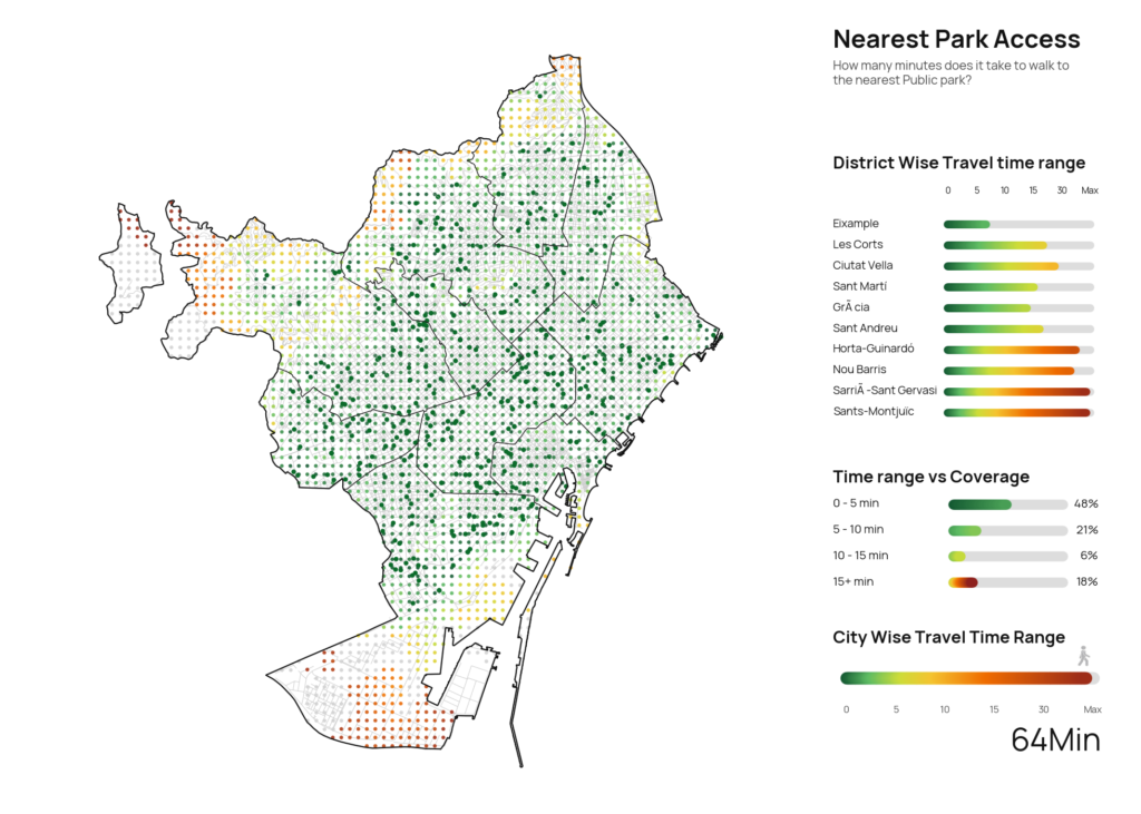
A city can have many parks and still feel unequal in the way people actually reach them. That is what […]
A city can have many parks and still feel unequal in the way people actually reach them. That is what […]