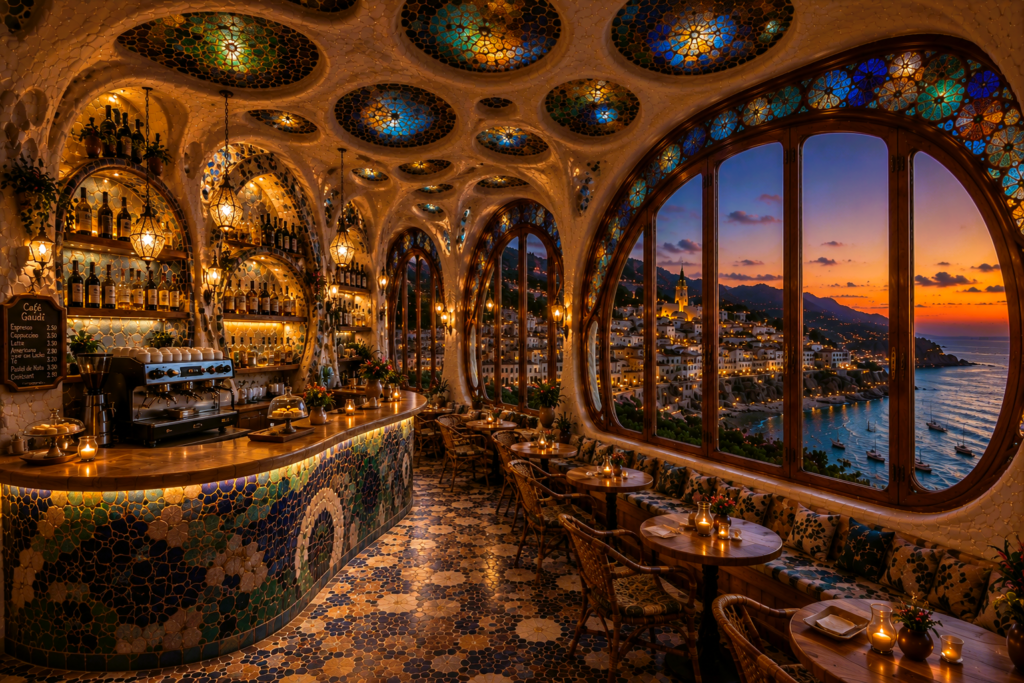
What If Gaudí Designed a Café in Costa Brava?
Introduction Antoni Gaudí is often associated with some of the most recognisable buildings in the world. From the soaring towers […]
Introduction Antoni Gaudí is often associated with some of the most recognisable buildings in the world. From the soaring towers […]
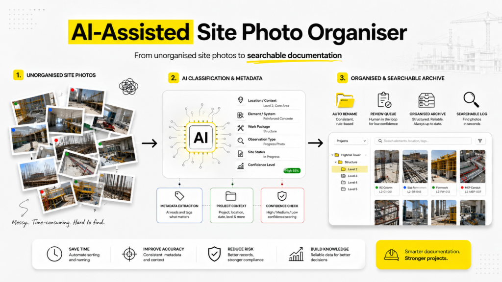
Site photographs are an essential part of architectural and construction documentation. They record progress, site conditions, defects, material installation, coordination
Artificial Intelligence is entering architecture in many different forms. Some tools generate images. Some read documents. Some predict project risks.
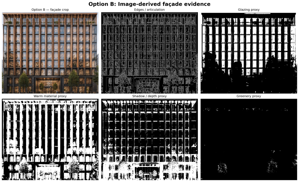
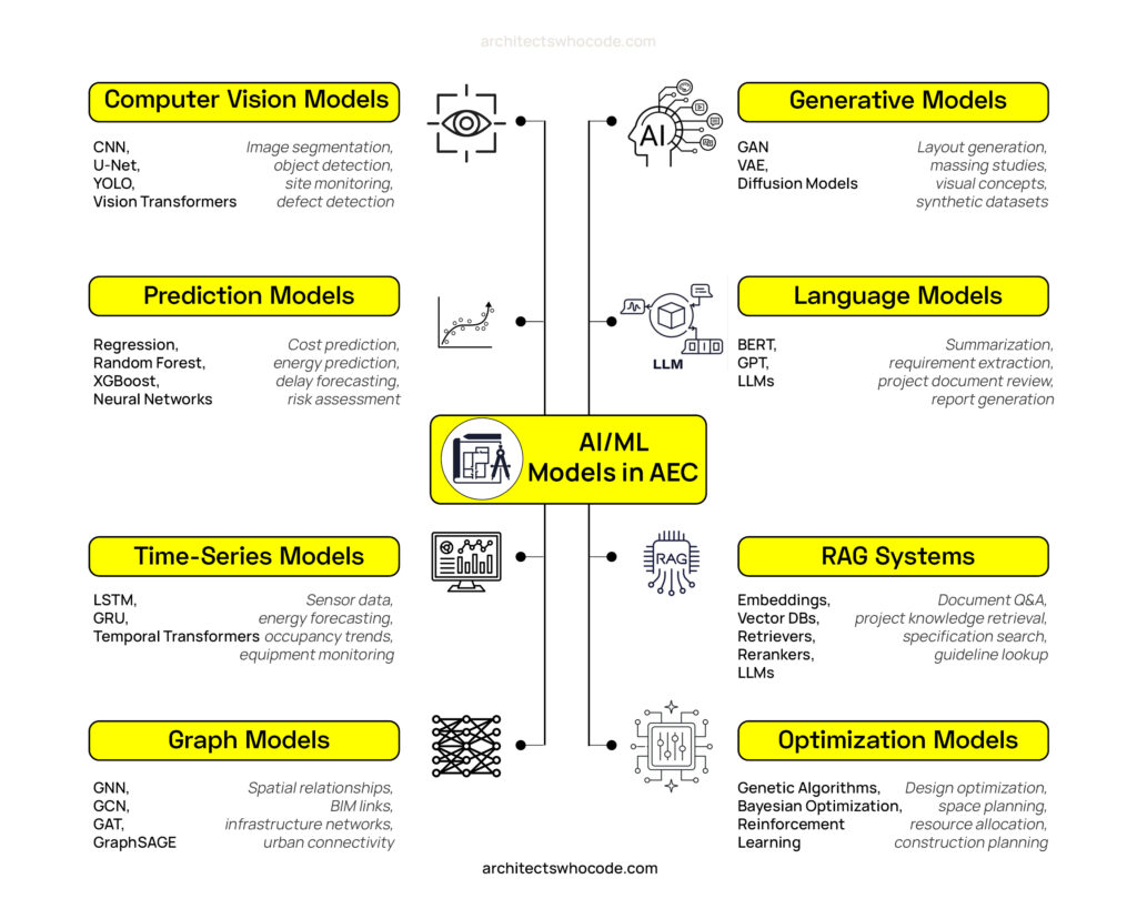
Can image-derived visual cues support first-pass design review? Design teams rarely move forward with one idea from the beginning. Before
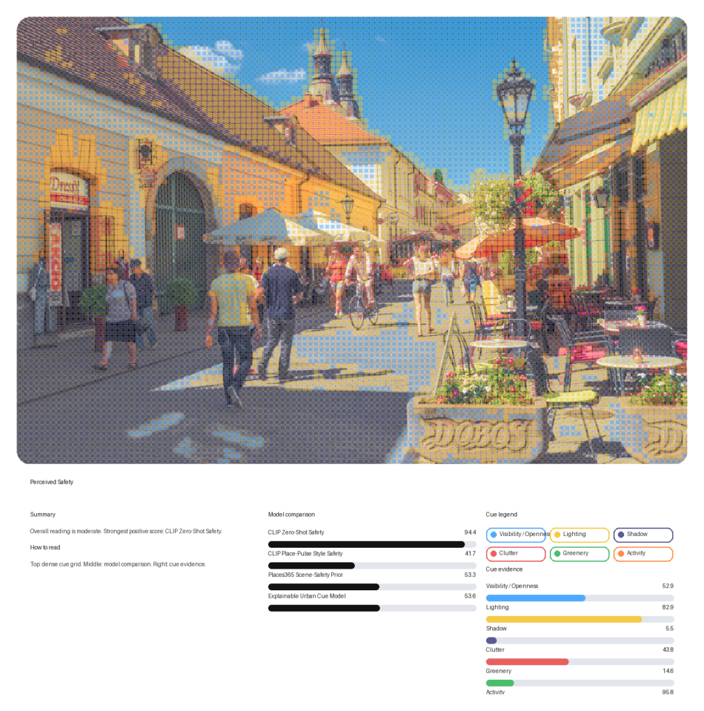
How consistent are AI predictions in street views? When we talk about street safety, we usually think about crime data,
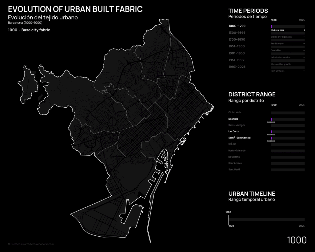
A practical workflow for understanding how cities grow over time Cities are usually mapped as fixed objects. We see building
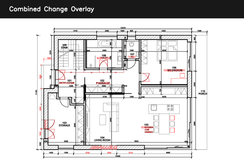
There’s a part of architectural workflow that hasn’t changed much in years Revision checking : Two drawings.Side by side.Zoom in,
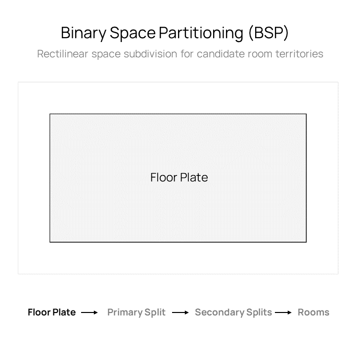
Introduction Early-stage space planning in architecture is often driven by intuition. Designers sketch zones, test arrangements, and gradually refine layouts
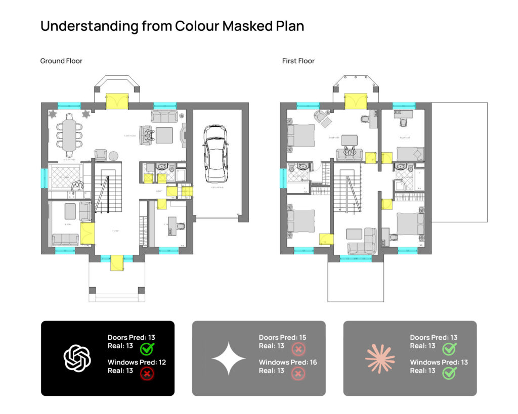
I kept thinking about this while testing multimodal AI tools on architectural drawings. We often say these models are getting
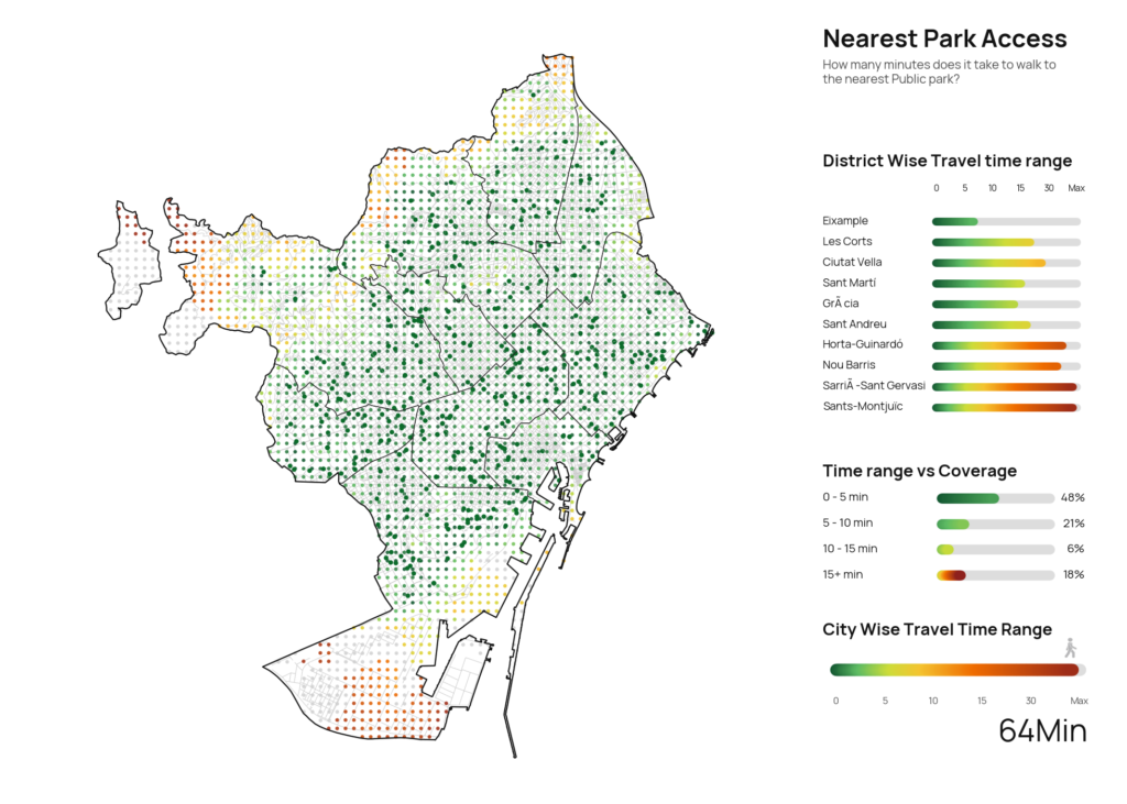
A city can have many parks and still feel unequal in the way people actually reach them. That is what