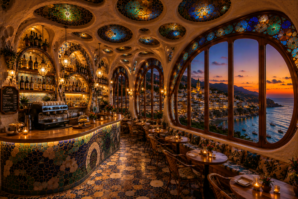
What If Gaudí Designed a Café in Costa Brava?
Introduction Antoni Gaudí is often associated with some of the most recognisable buildings in the world. From the soaring towers […]
Introduction Antoni Gaudí is often associated with some of the most recognisable buildings in the world. From the soaring towers […]
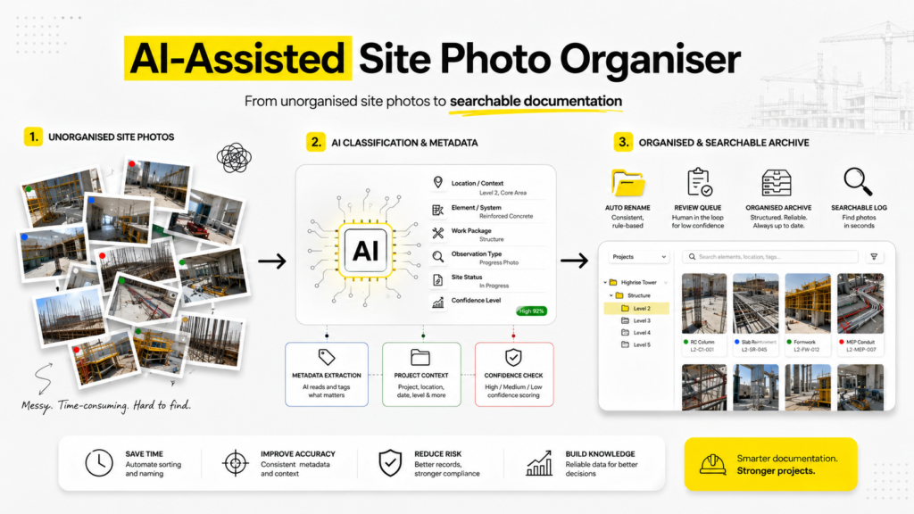
Site photographs are an essential part of architectural and construction documentation. They record progress, site conditions, defects, material installation, coordination
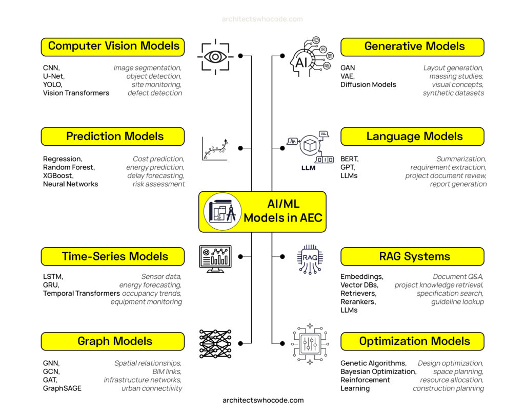
Artificial Intelligence is entering architecture in many different forms. Some tools generate images. Some read documents. Some predict project risks.
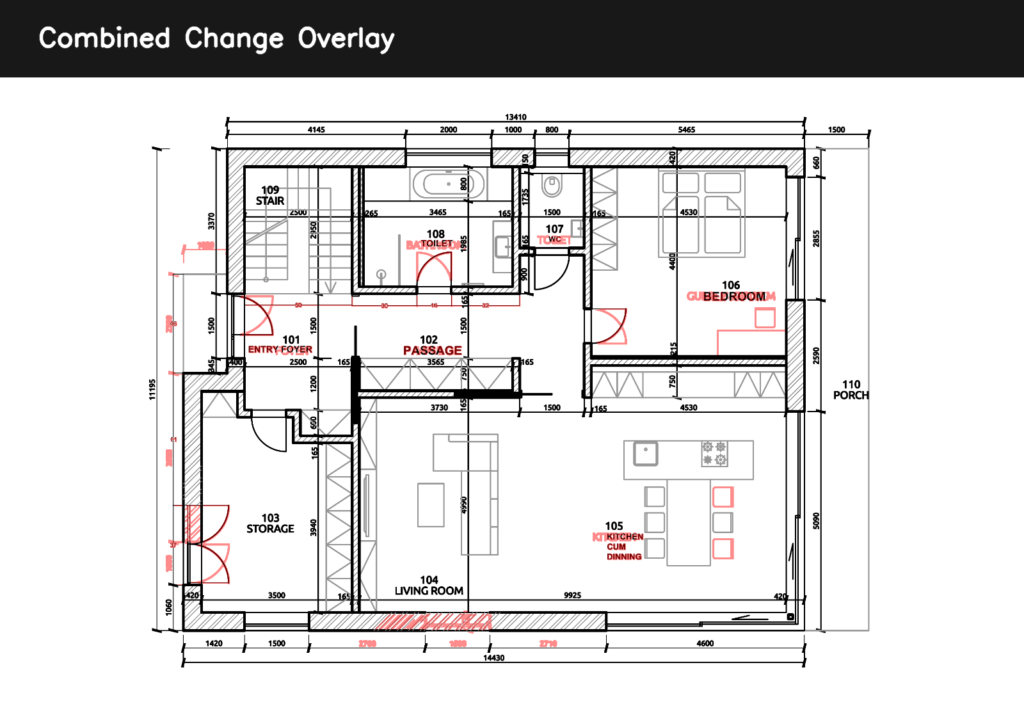
There’s a part of architectural workflow that hasn’t changed much in years Revision checking : Two drawings.Side by side.Zoom in,
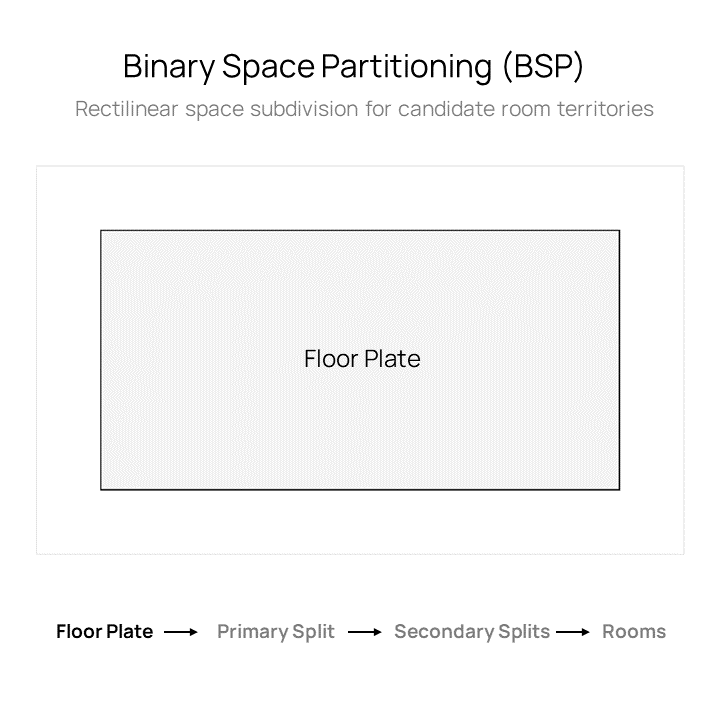
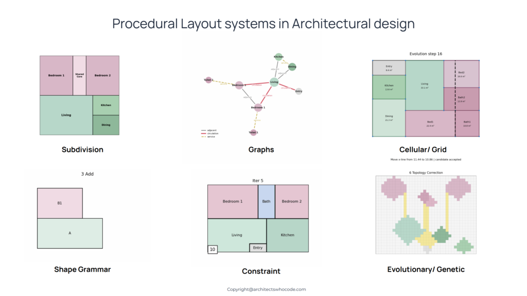
Introduction Early-stage space planning in architecture is often driven by intuition. Designers sketch zones, test arrangements, and gradually refine layouts
I kept thinking about this while testing multimodal AI tools on architectural drawings. We often say these models are getting
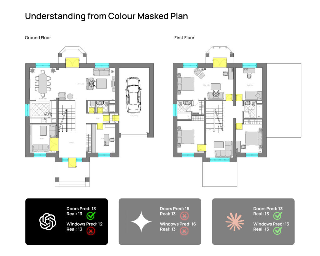
There’s something slightly incomplete about the way we usually read architectural drawings. Plans tell us where things are walls, rooms,
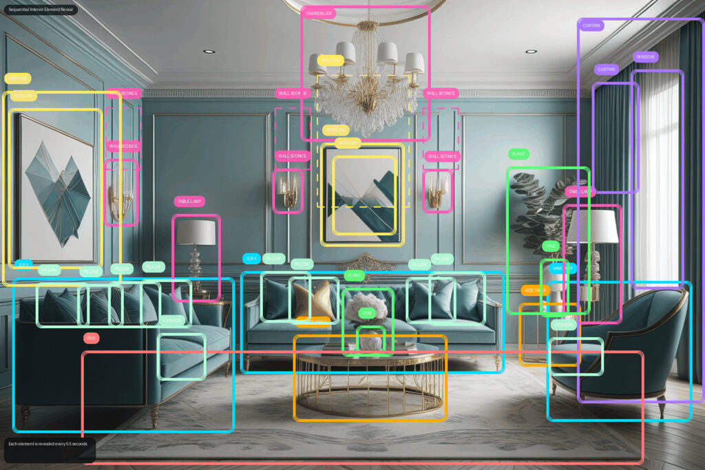
From visible elements to spatial interpretation Introduction Interior images are usually read in a very instinctive way. We look at
Introduction Cities are often described as engines of opportunity, places where access to education, healthcare, mobility, and culture is concentrated.
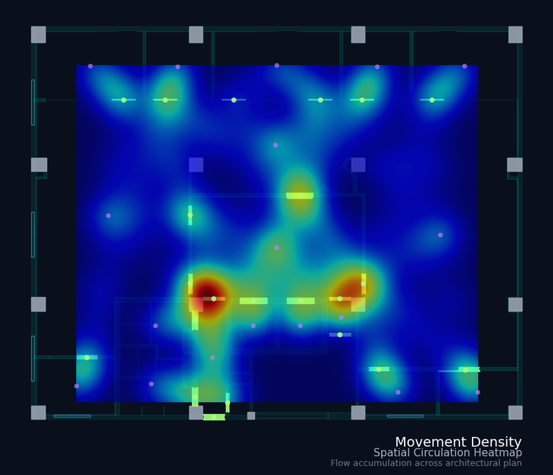
Architectural layouts are traditionally drawn, line by line, room by room, decision by decision. Every wall, every connection, every proportion